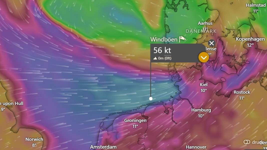
The low-pressure system "Joshua" reaches Germany on Friday night and develops into the first strong autumn storm of the year. Gale-force winds of up to 120 km/h are expected on the North Sea coast, and squalls are also expected on the Baltic Sea. The water level forecasts predict storm surges in the North Sea and low water in the Baltic Sea. If you can, you should secure your boat.
Storm for days
Storm depression "Joshua", also known internationally as "Benjamin", will initially hit the coasts of Belgium and the Netherlands today, Thursday. Gale-force winds are possible, particularly in the province of Zeeland. The Netherlands has issued the second-highest warning level "orange" for the entire coastal region.
The depression will then reach the German North Sea coast on Friday night. The German Weather Service (DWD) warns of gale-force winds or gale-force gusts (11/12 Bft., 105 to 120 km/h). On Friday, the entire north will be under control and, according to the DWD, will bring "widespread stormy gusts, occasionally gale-force gusts (Bft 8/9). In the coastal area of the North Sea, heavy squalls (Bft 10). Directly on the North Sea hurricane-force gusts (Bft 11), especially in the morning onshore gale-force gusts (Bft 12). Wind from west-southwest." The depression will also bring heavy showers and even brief thunderstorms.
The North Sea coast is particularly affected, especially the area from East Frisia via the Elbe estuary, Dithmarschen to Sankt Peter-Ording, as DWD meteorologist Karsten Kürbis told NDR. Kiel meteorologist Sebastian Wache is forecasting gale-force winds for the west coast of Schleswig-Holstein and up to 110 kilometres per hour on the east coast.
"The problem with this low pressure system is that it will not have passed through on Friday, as it will continue to be blocked in the east by an area of high pressure," explains Sebastian Wache, "so we will also experience very stormy days on Saturday and Sunday." The changeable and windy weather, especially in the north, will therefore remain.
Storm surge on the North Sea, low tide on the Baltic Sea
The current curve forecast sees the evening high tide on Friday, particularly in the Elbe and on the west coast up to Büsum, at storm surge level with up to 1.90 metres above mean high tide. The East Frisian coast, Dollart, Jade and Weser are also currently forecast to have higher water levels, but no storm surge. Elevated water levels are also expected in the following days.
On the Baltic Sea, however, meteorologists are expecting lower water levels because the wind is pushing the water away to the east. In the Kiel Fjord or the Bay of Lübeck, for example, around 70 cm of water may be missing on Friday.
On land or in the water: secure boats!
Some boats are still in the water. They should be well fendered and, if possible, fitted with additional mooring lines. It doesn't hurt to take a close look at the mooring lines: are they sufficiently dimensioned and free of damage? If you have to expect lower water levels in the Baltic Sea, you should lengthen the mooring lines. It is also advisable to tie them to the jetty and not on board so that they can be secured from shore without anyone having to climb down into the boat.
Motorboats with high superstructures and a flat underwater hull in particular offer the wind a large surface to attack. Boats that are still in the water should point their bow into the wind if possible. Whether on land or in the water, biminis and awnings unnecessarily increase the area exposed to the wind and should be removed during storms. In outdoor winter storage, special attention should be paid to the trestle on which the boat is standing: it should be large enough and the boat should rest well on it.

