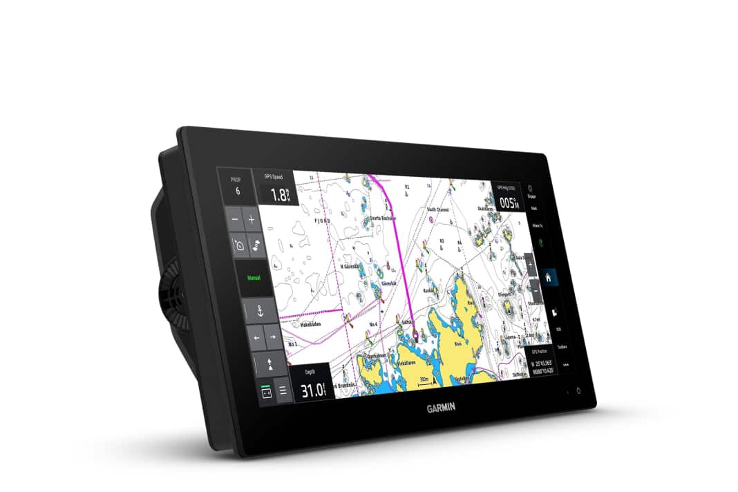


Garmin is expanding its range of map plotters with a model in ultrawide format. The new GPSMAP 1523xsv with its 15 inch (38.1 cm) screen diagonal offers significantly more display area than conventional devices, but only requires the installation height of a 9 inch plotter. This makes it easier to integrate into existing helm stations.
More space for important information
The wide IPS display with a resolution of 1920 x 720 pixels allows several applications to be displayed simultaneously. For example, users can display map material, echo sounder images and engine data side by side without having to switch between different screens. Additional frequently required information can be displayed via sidebars. Garmin Navionics+ or Garmin Navionics Vision+ Premium charts are available for navigation. In addition to detailed water information, these also offer functions such as relief shading for vivid visualisation of depth contours or high-resolution satellite images. The integrated Auto Guidance+ technology enables automatic route planning, taking shoals and other obstacles into account.
Echo sounder functions and connectivity
The GPSMAP 1523xsv has integrated Ultra HD SideVü and ClearVü echo sounders for detailed underwater visualisations. However, a separate, optional Garmin transducer is required to use these functions. The device also supports Panoptix and LiveScope echo sounders for real-time underwater images as well as traditional CHIRP echo sounders. Other devices such as autopilots, radar devices or cameras can be integrated via standardised interfaces such as NMEA 2000 and NMEA 0183. The OneHelm solution enables the integration of third-party devices. Engine data such as engine speed and fuel flow can be sent to the chart plotter via the J1939 network. The device is also compatible with Garmin's force-trolling engine and offers corresponding control and navigation functions.
Technical data
- Display size: 15 inch (38.1 cm) Ultrawide
- Resolution: 1920 x 720 pixels
- Display type: IPS touchscreen
- Dimensions: 42.5 x 17.5 x 7.6 cm
- Weight: 2.3 kg
- Water resistance: IPX7
- Power supply: 10-32 V DC
- Power consumption: Max. 40 W
- Connections: NMEA 2000, NMEA 0183, Garmin Marine Network, J1939
- Integrated echo sounders: Ultra-HD-SideVü, ClearVü
- Map compatibility: Garmin Navionics+, Garmin Navionics Vision+
- Satellite systems: GPS, GLONASS and Galileo with 10 Hz update rate
- Sailing functions: integrated SailAssist functions with laylines, virtual start line, drift information, wind data and more
- Force Trolling Motor compatible: including steering and navigation functions
- ActiveCaptain app: access to smart notifications, software updates, the Quickdraw community or OneChart
- ANT+ technology: Connections to other Garmin products such as the quatix marine multisport smartwatch, the gWind Wireless 2, GNX Wind marine instruments and wireless radio remote controls
- Coupling with optional inReach for satellite communication to write messages via the plotter's keyboard
