Baltic Sea: Easily track environmental protection areas on your smartphone
Andreas Fritsch
· 22.09.2023

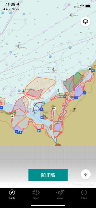
The app is called "WWF Sea Chart" and is available free of charge in the app stores of Apple and Google to find. It shows the exact boundaries and zoning of the protected areas on the coast of Mecklenburg-Vorpommern in a very simple, clear form. It was created a few years ago, as the WWF, together with the associations, agreed on a number of voluntary protection zones in addition to those already established by law, some of which are only closed for certain breeding seasons or only have minor restrictions.
This was first implemented in the waters of the Greifswalder Bodden south of Rügen, followed later by the Wismar Bay. The purpose of the voluntary agreements is to avoid having to pass further laws, which often entail further or even permanent restrictions that may overshoot the mark and make the areas unusable for skippers at some point.
The areas are regularly monitored by conservationists to check how the flora and fauna worthy of protection there have developed over the years. This has worked well in the Greifswald Bodden for years and has helped to relax the otherwise somewhat hardened fronts between nature conservationists and water sports enthusiasts.

Environmental protection areas shown on nautical chart
In addition to the Greifswald Bodden, the app now also includes the voluntary exclusion and protection zones in the Bay of Wismar. The Vorpommersche Boddenlandschaft National Park will also be added shortly. The protection zones are clearly displayed on a nautical chart, allowing boaters to find their way around and easily check which rules apply using the colour-coded zones. The app has also been expanded to include beautifully illustrated lists of the bird and fish species that occur in the protected areas.
