Baltic Sea tips: 10 places full of magic - hidden gems to fall in love with
Boote Redaktion
· 22.06.2023
The following places are presented in more detail in this article:
- 1 Utklippan: Silent gateway to the archipelago
- 2. Kråkön: Quaint fishing village in the far north
- 3. Hallands Väderö: Archipelago in miniature
- 4 Frederiksø and Christiansø: islands that belong to sailors
- 5th Kökar, Sandvik: Romance for novel readers
- 6 Birkholm: The jewel of the Danish South Sea
- 7th Väderöarna: Storm-torn outpost
- 8 Flakfortet: A fortress for mooring
- 9th Deviner See: Anchoring luck in the reed lagoon
- 10th Albuen: Detour into paradise
Sweden
1st Utklippan: Silent gateway to the archipelago
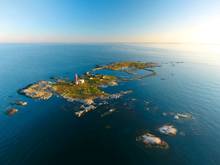
A lighthouse, visible from afar on the way across Hanö Bay. Two islets with a handful of rarely inhabited cottages. A few scattered skerries all around. Sweden's south-eastern outpost is as unspectacular as it is charming. The tiny archipelago conveys a first hint of the archipelago world. Not in soft green as further north, but barren. Covered only with a few ochre-coloured lichens and flowering grasses, the rounded granite rocks defy many a harsh storm and the rolling surf far out at sea.
Boaters travelling north do not need to make a detour to get here. The rocks are on the way to Kalmarsund and the Stockholm archipelago. At their centre is a sheltered harbour that is accessible from east and west and can therefore always be approached from leeward, even in heavy seas. You should take advantage of this, as the entrances are narrow and surrounded by shallow cliffs, and are sparsely lit at night. Cross currents can make the entrance even more difficult in strong winds.
Directly behind it are small natural harbours on both sides; the actual harbour, a simple basin with quay walls, is located behind another narrow access road. It can get crowded in the harbour during the season; a glance at the webcam provides information about available berths. Electricity is only available at the eastern pier, drinking water not at all. Utklippan's luxury consists of crystal-clear water in the harbour and dry toilets in small wooden huts with hearts in the door: Trissebuden with a sea view.
Seagulls, geese and ducks inhabit the islands and a colony of seals inhabit the rocks on the shore. Together they form a choir whose song rings out over the islands late into the night. There is a lighthouse on the southern archipelago, which now only shines dimly as a symbol. In summer, it is open to visitors who can enjoy the view from the top over the strangely shaped rocks and the sea in front of them.
Sweden
2. Kråkön: Quaint fishing village in the far north
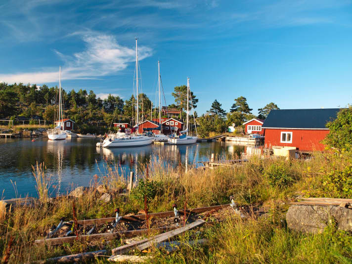
In the nautical chart, the harbour bay of Kråkön is only marked as a blue area, the description in the sailing guide is also open to interpretation: When entering the harbour, keep to the centre and keep about 15 metres away from the shore after the small stone. With a lookout at the bow, the passage through the narrow entrance is successful and the tension is rewarded: at the communal floating jetty, you are surrounded by historic fishermen's huts. About four yachts can moor here, often alone or in pairs, the mooring fee is more symbolic and is placed in a wooden box. Apart from a dry toilet and a water pump, there is no infrastructure, but there is quaint fishing charm and a chapel from the 16th century. You can also use the wood-fuelled island sauna. Tip: The neighbouring island of Agön is also worth a visit, but is easier on the nerves.
Sweden
3. Hallands Väderö: Archipelago in miniature
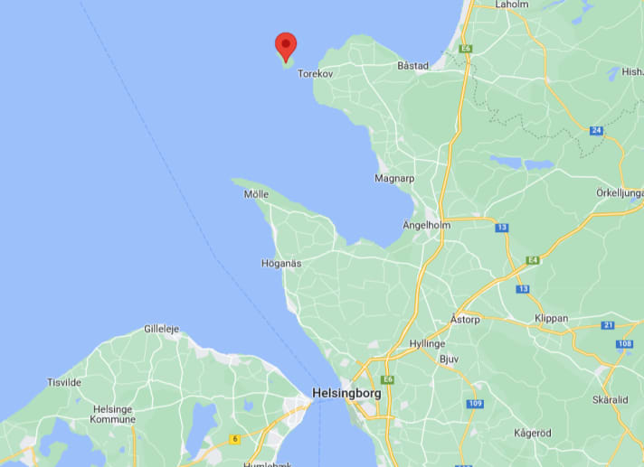
The archipelago in the Gothenburg area is too far away? You can also experience the Swedish rock archipelago feeling on a short Kattegat round trip: Off to Hallands Väderö, which is only a short day's journey north of Helsingborg. The area, which is just two nautical miles long and just as wide, attracts visitors with several anchor bays, solitude, typical archipelago nature, old trees, bird and seal sanctuaries and wonderful sunsets.
Denmark
4 Frederiksø and Christiansø: islands that belong to sailors
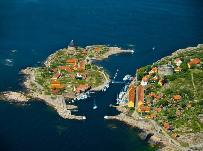
Almost everyone has heard of them. And yet there are many boaters, too many, who have never moored on the Pea Islands, this easternmost outpost of the Kingdom of Denmark. What an oversight! Because the two rocky islands, separated by a narrow channel to the north of Bornholm, are among the most beautiful and unspoilt destinations anywhere.
It is almost 80 nautical miles on a direct course from the east coast of Rügen. But if you first stop in Gudhjem or Svaneke on Bornholm, you can reach Christiansø and Frederiksø in just two or three hours - and immediately find yourself in a different world.
The islands, which are surrounded by fortress walls and were first settled in the Middle Ages, seem to have fallen out of time. In some places, you feel like you've been transported back to the 16th century, the buildings are so sparse and original, the pace so calm, the air so pure.
In July and August, the streets of Christiansø's tiny town centre can get particularly crowded during the day. Even the harbour, which strictly speaking only consists of a long pier, becomes a sometimes bizarre-looking jumble of small package trailers. But in the evening, when the last passenger ship has leftWhitewashed farmhouse in the tranquil island village. Birkholm is almost as shallow as the neighbouring waters of the Danish South Sea. Then the pea islands belong to the sailors.
There are several places of interest here, such as the large lighthouse or the museum in Lille Tårn, several pretty bathing spots, the old garrison facilities, one (1!) restaurant and a grocer's shop that serves the famous herbal herring (Kryddersild). The real attraction of the pea islands, however, is their marvellous remoteness.
Åland
5th Kökar, Sandvik: Romance for novel readers
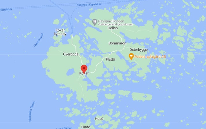
The Kökar archipelago forms the southern tip of the Åland archipelago and is a world of its own. Kökar became famous thanks to the bestselling novel "Ice" by Ulla-Lena Lundberg. It tells of the barren life of the islanders. If you ignore the modern ferry and yacht traffic, it's easy to understand. At least when you drop anchor in Sandvik, known as Gammelhamn. On its shore, the 16th century church mentioned in the book defies wind and weather.
Denmark
6 Birkholm: The jewel of the Danish South Sea
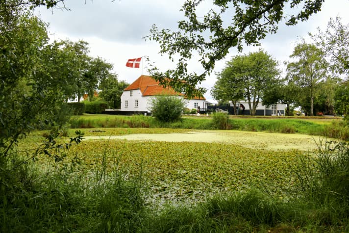
The moraine island is one of the smallest inhabited islets in Denmark. There is not much to discover on Birkholm, which at 100 hectares is smaller than Heligoland, while its highest point is just two metres above the surface of the sea. But if you pass the narrow harbour entrance, you will inevitably be overwhelmed by a feeling of tranquillity: no cars, souvenir shops or restaurants. Instead, you can enjoy unspoilt nature and precious silence. The harbour fee is dropped into a box on a trust basis. There is electricity, two seawater toilets and a barbecue area right by the harbour. Fresh water, a self-service kiosk and a small coin-operated shower block can be found at the island's community centre one kilometre away
Right next to the harbour basin is a child-friendly, gently sloping beach with a view of the endless row of passing boats on the Mörkedyb, the channel that connects the western part with the south-eastern part of the shallow island sea of the Danish South Sea. Many crews who have made it to this gem once come back regularly - because the saying "less is more" is rarely as true as it is at Birkholm.
Sweden
7. väderöarna: storm-torn outpost

The name "Weather Islands" says it all here; on average, a 5 Beaufort wind blows from west-south-west over the small archipelago off the coast of Bohuslän. Nevertheless, the bare rocky humps are an archipelago dream in summer. The many islets and rocks are relatively calm even in strong winds. Thanks to their exposed location, they have always served as a refuge for pilots and fishermen. Many seafarers have passed the waiting time while weathering with rock paintings.
The main island of Storö was inhabited until 1966, but today the former pilot station is a popular restaurant with overnight accommodation. There is electricity, showers and toilets in the small harbour basin, which is formed from rocky outcrops. The basin is often overcrowded in the high season. Things are a little quieter in Strömsund, which is also very popular. You can moor alongside some of the steeply sloping rocks. There are also wooden bridges for mooring. Due to the narrow width of the sound, a maximum of two yachts can be moored in a packet. You should definitely visit the former pilot lookout on Storön. From there you have a spectacular view of the Skagerrak and the sunset.
Denmark
8th Flakfortet: a fortress for mooring
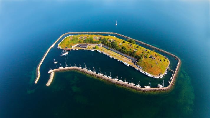
Flakfortet is one of Denmark's most bizarre mooring options. Although only four nautical miles from bustling Copenhagen, the artificial island is comparatively isolated in the Øresund. Built by the military as a gun emplacement at the beginning of the 20th century, it now serves as a conference hotel. Good for water sports enthusiasts: one condition of the sale was that the island remained open to the public. It can therefore be approached without any problems. To protect the bunkers and gun emplacements from the swell, the island is enclosed by a breakwater, with the space in between serving as a harbour. Shower tokens are available at the kiosk, where you can also buy some food and the most necessary summer essentials such as ice cream and barbecue charcoal.
At the height of the war, up to 550 men were stationed in the underground casemates. Today, the historic bunkers can be visited. One of the highlights is starting up the over 100-year-old single-cylinder diesel generator that once supplied the fortress with electricity. Flakfortet draws its special charm not only from its exposed location in the sound, but also from the contrast between green summer land and gloomy bunkers. The only downside: the mooring fee is comparatively high.
Germany
9th Deviner See: Anchoring luck in the reed lagoon
Lake Devin on the Strelasund is an absolute insider tip, even for those who know the area and local heroes. To the west of the Neuhof marina, there is an inconspicuous eye of a needle in the green through which you can enter the small lagoon. In the middle of a nature reserve in complete tranquillity, surrounded by a belt of reeds, this is the perfect place to unwind for a night. If you want to turn the savings on harbour fees into a hot meal, you can take the dinghy to the nearby marina to enjoy delicious barbecue specialities at the "Sund-Angler". Back in the reeds, you can watch birds such as marsh harriers and terns while enjoying a sundowner.
Please note that a minimum distance of two metres from the shore must be maintained at all times, even when travelling by dinghy. Caution is also required at the narrow entrance to the lake. The shallowest point is 1.70 metres. The peninsula itself, with its rare flora and beautiful view over the Strelasund, is ideal for a shore excursion.
Denmark
10th Albuen: Detour into paradise
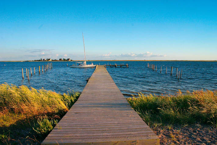
Just a day's journey from the German coast lies a real gem on the edge of the main shipping channel to the north, the Great Belt. The bay behind the 7.5 kilometre long Albuen headland is a secluded place where hardly any crew unfamiliar with the area will stray. This is a mistake, as the jetty of the sailing clubs based in Nakskov invites you to enjoy a Robinsonade in summer weather. Outside of the holiday season, you will most likely be able to enjoy solitude and the unique landscape here on weekdays. On the seaward side, the rough waters of the Belt flow along the stony beach, and a few metres to the east lies the shore of the lagoon-like bay. Rare seabirds can be seen from afar through the binoculars at the observation centre. Please note that the approach is only possible with a draught of less than 1.50 metres.

