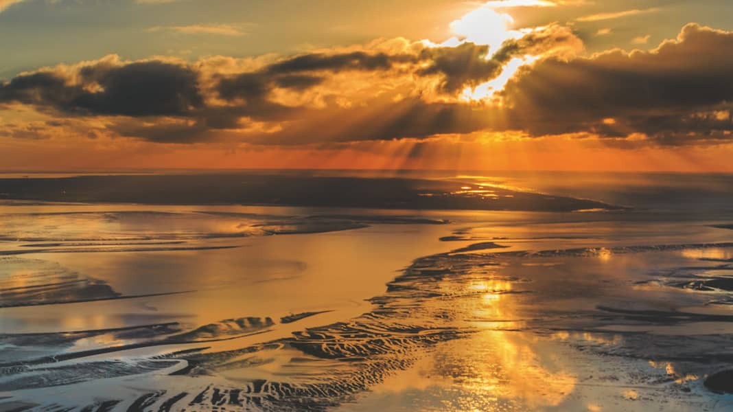
They are like a pair of dissimilar siblings, theWest Frisian Waddenzee and theEast Frisian Wadden Sea. Protected from the open North Sea by a chain of islands and bordered on the mainland by high dykes, they line the longFriesland coast.
At first glance, they look and feel almost identical. At second glance, however, it becomes clear that the Dutch one is not just the bigger of the two brothers: he has to be the first to face the west wind. The more changeable his nature, the rougher his mood.
It is a fascinating area, no longer land and not yet sea: where the waves sweep over the bottom without obstruction at high tide, dry sand and soft silt stretch out at low tide, criss-crossed only by deep, fast-flowing tidal creeks. We will get to know its big brother over the next few days.


The opportunity presented itself a year ago when Anton van den Bosch from Neptune Marine called the editorial team: "We're ferrying a brand new Elling E6 to Neustadt for the Boat Show. Do you want to be on board?"
At least for the first section of the route through the Waddenzee, this can be arranged. Although the weather forecast for the days in question in mid-April is a challenge, as strong winds are forecast, the almost twenty-metre-long yacht with its 900 hp main engine - a Volvo Penta D13 - and the Seakeeper gyro stabiliser located deep in the hull is actually equipped for any sea state.
Our journey begins in Stavoren on the east coast of the IJsselmeer. Under blue skies and bright sunshine, the wind is blowing freshly from the north-west across the long harbour basin. Our Elling is quickly spotted. The water is slapping restlessly against her hull.
On the other hand, a whole group of cumbersome flat-bottomed boats, still slumbering under tarpaulins and tarpaulins next door, are completely unperturbed by the choppy conditions. There are still a few weeks to go before the start of the season.
Nevertheless, we are already expected: Anton waves from the aft deck of the Elling, and after we have brought our things on board and stowed them below deck, a short walk takes us from the berth at the bascule bridge along the brick buildings on Havenweg to the harbour entrance.
The view gives us a salty foretaste of what awaits us: white crests of foam on the whipped-up IJsselmeer and an approaching wall of dark clouds that is just swallowing up the sun.
Soon it's singing in the rigs, and we're lucky that it's only a few steps over to the parlour of the "Vrouwe van Stavoren".
The twelve nautical miles on a northerly course to the Kornwerderzand lock are behind us after just over an hour the next morning. Beams of light keep pouring down from the cloud-filled sky as we head for this eastern exit of the IJsselmeer. The western one is fifteen nautical miles away from here at the other end of the Afsluitdijk near Den Oever on the North Holland peninsula.
It was not until the early 1930s that the dyke was completed; a construction project of the century that separated the Zuiderzee, which until then had been feared for its storm surges, from the Waddenzee, fenced it in and thus not only made it a much more predictable inland waterway, but also enabled massive land reclamation.
This is why a former island like Urk now lies on the mainland coast. Where today - five metres below sea level - lies the polder landscape of the province of Flevoland, home to more than 400,000 people, there was once only water.
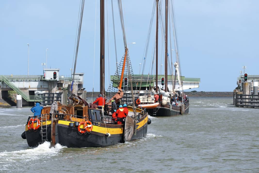
As the traffic lights turn green, Anton steers the Elling together with two traditional sailing boats on a transfer voyage through the massive steel double gates into the smaller eastern chamber of the Lorentzsluizen, part of the Kornwerderzand tidal barrage. Outside, the tide is still rising.
We reach the top just as quickly. The traffic on the A7 motorway, which runs over the Afsluitdijk, has already been stopped, and without wasting any more time, the swing bridges on both carriageways open for our trio.
Once out of the shelter of the elongated pier, one of the two flat-bottomed boats turns into the wind to set sail. The spray immediately explodes over the round bow and sweeps aft in wide veils. In spite of the oil, one of the men on the other side abandons the manoeuvre, rejoins the fairway and is happy about his engine.
The colour of the Waddenzee on this day is a deep grey with a tinge of blue or brown when holes in the clouds pass by, and the white of the whitecaps. Buoys tumble in the sea. The wave from abeam is no fun for us either, but when the skipper switches on the stabiliser and gets the gyro going, the rolling decreases significantly. Our destination for the day is the island of Terschelling. The route there now leads northwards, initially close under the coast, via the Boontjes, a well buoyed and lighted channel up to Harlingen, where we turn into the even better developed main fairway, which is also used by the ferry between the mainland and Terschelling.
The traffic is correspondingly lively: an old cutter comes towards us from crab fishing, its hull full of rusty streaks of grief. As it pounds through the sea, a cloud of hungry seagulls hangs over its stern. A dredger follows, then a sailing yacht, its mast swaying like a metronome against the pale sky.
We also encounter the ferry itself heading in the opposite direction: the "Friesland" is a real seagoing vessel, with a high freeboard and bulky stern. An indication of the conditions that can prevail here.
Only the nautical chart reveals that Langezand now lurks on the port side, less than two metres below the crests of the waves. On the starboard side, the even larger Ballastplaat stretches out, just as hidden. Only its highest point is visible - the small island of Griend, with even sparse vegetation clinging to its surface.
Like an artery between taut muscles, the fairway runs between the sands, soon as slightly wider than Blauwe Slenk, until it meets a new obstacle: the mighty Waardgronden south of the island of Vlieland.
This is where the depression joins the Inschot, also navigable, coming from the south, and together they now head north towards the North Sea, like a river that picks up more and more tributaries on its way. Its "mouth" in this case is the Vliestroom, the wide yet shallow sea inlet between Vlieland and its neighbour to the east: Terschelling.
The coastline of Terschelling is now clearly visible, with lots of sand - the Noordsvaarder - and behind it rising dunes of impressive height and dark patches of bent pine trees in the valleys. The West Meep branches off to starboard, a deep inlet, and with it the main fairway. However, we choose a different route a little further north and just below the island.
There, the Schuitengat feels its way past Jacobsruggen and Grote Plaat to the harbour of West-Terschelling, which is already recognisable not only by a dense ridge of masts and the houses behind them, but above all by the chunky ashlar of the Brandaris lighthouse.
Less than half an hour later, we pass an old ocean-going tugboat, a buoy layer and a packet of flat bottoms and enter the long, dredged tube of the island harbour until we reach the floating jetties of the Passantenhaven at its end. Time to get our legs moving again - after the "jetty", of course.
Fine sand swirls across the tiled path that leads from the nautical school at the marina into the village. Most of the moorings are still empty and even the bicycle stands are still deserted. Here, too, the season is far from over. Once in the shelter of the narrow alleyways, however, the density of tourists increases. Somehow, all roads here lead to the vuurtoren, the lighthouse in the centre of town. Despite its yellow clinker bricks and rectangular design, which from a distance is slightly reminiscent of a humdrum silo, Brandaris is a true veteran on this coast: this year, the lighthouse celebrates its 425th birthday, making it one of the oldest in the world to have been built exclusively for this noble purpose.
If you then follow the steep sandy paths up the dunes just west of the village - and don't stumble across the unfortunately unavoidable remains of the German bunker building mania - you will be rewarded with a magnificent panoramic view. From the island's dunes, which disappear into the eastern distance, across the harbour and mudflats, whose winding structures slowly become visible as the water recedes, to the Vliestroom, where the Wadden and Noordzee seas meet above the barre in a white strip of surf. We meet up again at the Heksenketel in Willem Barentszstraat, where, between flying brooms and incantations, we actually warm up quickly over koffie and likeur.
Golden evening light also accompanies us on the way back to the boat.
But the next day dawns all the more gloomy: the sky lies heavy and seemingly immovable over the island like an old concrete slab. St Brandarius could have given us a little help in his role as bringer of light. But it's no use, we have to get on to Ameland. For this reason, we cast off our lines a good hour before high tide, as this is the only way we will arrive at the critical point of this stage at the right time - the high tidal flats of the Terschellingerwad.
The sand there can fall dry for more than a nautical mile, up to half a metre. The background of the spot in question glows a correspondingly poisonous green on the plotter.
Nevertheless, the line of the fairway crosses it unperturbed, as if it were a walk across a meadow. The ominous depth indication "only" refers to the chart datum, which for safety reasons is set even lower than the value of the already rare mean spring low water.
But with a tidal height of less than two and a half metres at mean high tide and a draught of one and a half metres, Anton plays it safe.
So we start to follow the winding buoy line through the invisible labyrinth south of Terschelling to the east, via Slenk, Noord Meep and finally Oosterrom. The "green meadow" on the plotter screen draws ever closer. Nothing outside indicates the critical moment.
The waves run evenly over the flat surface and yet the chain of red buoys ahead conveys at most a lukewarm feeling of safety. Then the exciting part begins - and after just a few moments, a glance into the stern water suddenly reveals what has changed:
White a moment ago, it is now foaming deep grey behind the stern. Dark clouds billow up, churned up by the propeller. What does the depth sounder say? "0.1 metres."
And suddenly you realise how gently the large yacht is sinking. It is the keel, which has been pulled down low to protect the drive, that is scraping the bottom like a sharp plough. But thirty tonnes in motion are not so easy to stop, and so we "slide" over this bump as well as the two or three others that follow.
From one moment to the next, our stern water regains its "healthy" colour - and the Wadden High is behind us. Terschelling ends and the North Sea welcomes us in the Westgat. The north-west creates an impressive chaos of breakers here. Fortunately, we don't want to go out today, but back into the mudflats, into the harbour of Ameland, which is already ahead on the port side. The deep Molengat will certainly take us there.

