Country: Finland
Area: about 3,000 km²
Of which water: 71 %
For most German skippers, a Baltic Sea cruise probably ends at Stockholm. However, those who take on the admittedly long journey to the northernmost tip of the sea are rewarded with a unique natural spectacle.
Where islands grow out of the sea
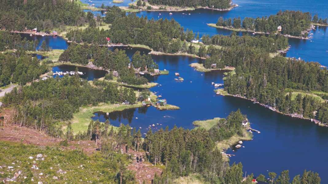
The Kvarken archipelago is located at the narrowest point of the Gulf of Bothnia, between the Finnish city of Vaasa and the Swedish city of Umeå. Although the archipelago with its almost 6,000 islands is not a national park, it has been a transboundary World Heritage Site since 2006. This is because it is considered a unique example of post-glacial land uplift. Here you can see how the land mass rises from the sea - according to various sources, between eight millimetres and up to one centimetre per year. As a result, the land area grows by one square kilometre per year, which is equivalent to 150 football pitches. The landscape is constantly changing due to the - in geological terms - rapid increase in land mass. Abandoned boathouses that were still standing in the water a few decades ago are now standing on dry land. The newly emerging land areas are known as De Geer moraines, with shallow lagoons forming between them.
A challenging water sports paradise
Merenkurkku, as it is known in Finnish, is a true paradise for water sports enthusiasts. However, rocks, shallow waters and narrow fairways also make the area challenging to navigate. Most of the sights can be reached by boat. No two rocky islands are the same. In the centre of Kvarken, on one of the Valsörarna islands, stands a red lighthouse designed by the architect of the Eiffel Tower. Today, like most lighthouses in Finland, it is automated. For many visitors to the archipelago, Replot is the starting point for exploring the islands. The World Heritage Visitor Centre is also located here, close to the longest bridge in Finland.
Travelling by boat
There are several beautiful anchorages. However, anchoring may be prohibited in some protected areas during breeding seasons. There is good infrastructure and a 40 metre long floating dock for visitors at Wasa Segelförening, Vaasa's official guest harbour. In addition to supply facilities, a modern service building and a restaurant, there is also a sauna, as in many Finnish harbours.
General information on national parks
National parks are retreats for plants and animals where nature is left to its own devices. At the same time, they attract millions of visitors every year precisely because of their unspoilt nature. And that is the intention: As part of the conservation objectives, people should experience nature here and thus recognise its value and worthiness of protection - a constant balancing act between nature conservation and tourism. National parks are divided into two zones. The core zones may not be utilised commercially or in any other way; humans are not permitted to intervene here. Visitors may only enter the marked paths. There are also restricted areas on the water and rules for sailing, mooring and anchoring. In the other parts of the national parks, you can usually move around freely. This second zone is to be preserved in its existing form through special care and utilisation, such as grazing with sheep.
