Navigation: Ghost ship on behalf of science - sailing drone spotted in the Baltic Sea
Hauke Schmidt
· 19.07.2024


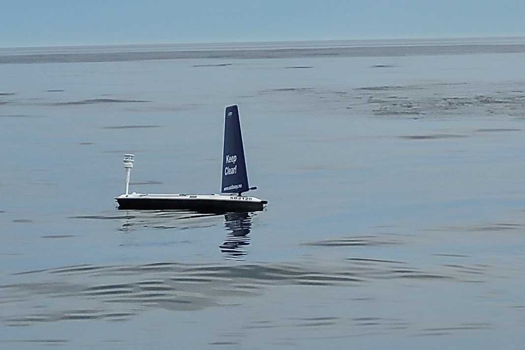
The sailing drone is two metres long and navigates autonomously. However, the vehicle has neither positioning lanterns nor AIS or a radar reflector. Particularly at night, it therefore appears completely unexpectedly when in doubt. This was also the case for Bernd Neumann, a reader of our sister magazine YACHT, who spotted the drone on the crossing to Sweden.
The mission of the Sailbuoy
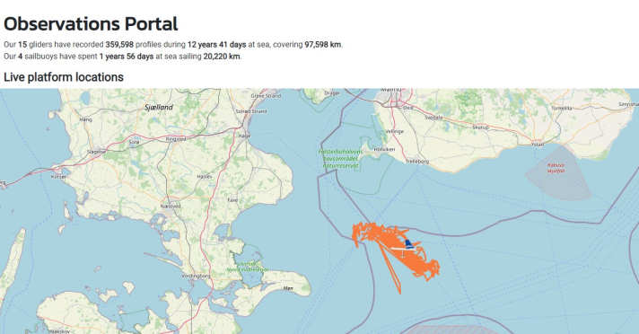
The Sailbuoy sailing drone was developed by the Norwegian company Offshore Sensing and is part of the Samba (Smart Autonomous Monitoring of the Baltic Sea) research project. It aims to revolutionise marine observation in the Baltic Sea by collecting the most comprehensive and detailed data set and making it freely accessible. The drone is operated by the Swedish Voice of the Ocean Foundation. It is currently operating north-east of Kriegers Flak and sails back and forth between the waypoints 55° 8.345'N, 12° 57.557'E and 55°1.803'N, 13° 10.226'E. She remains within a four kilometre wide corridor.
Important measurement parameters
The Sailbuoy is equipped with a large number of sensors that continuously measure important environmental parameters:
- Wind speed and wind direction: This data helps to understand the wind conditions in the region.
- Air temperature and air pressure: These parameters are crucial for weather forecasts and climate research.
- Wave height and wave period: Information on wave conditions is important for maritime safety and coastal protection.
- Water temperature and salinity: These measurements provide information about the state of the seawater and its changes.
The sailing drone investigates the effects of wind turbines
The data collected by the drone is intended to help measure the extent of so-called wind wakes. These are the areas behind the offshore wind farms where the wind speed decreases. The impact of the wind wake on the sea will also be analysed. Such data is important in order to better understand the ecological consequences of wind turbines and to further develop sustainable energy generation. The Sailbuoy continuously transmits its position and the collected data via the Iridium network. Anyone interested can view this data on the View the website of the Voice of the Ocean Foundation. In addition, the current position of the sailing drone and all other measuring platforms of the Voice of the Ocean Foundation can be tracked via a Live map track.

The sail drone cannot evade
The Swedish Sjöfartsverket provides information in the "News for sailors" (NfS) on the use of the measuring device carrier. There it is explicitly pointed out that the Sailbuoy has no lights, no radar reflector and no AIS and is not able to recognise obstacles. The NfS also state that no consideration needs to be given to the drone as it is robust enough to survive collisions. Marcus Melin from the Voice of the Ocean Foundation nevertheless urges caution: "Ships should try to stay away from the drone, especially yachts and pleasure craft. Also, no one should interact with the scientific platform in any way. However, there is nothing wrong with taking photos from a respectful distance; in fact, we would love to see the Sailbuoy in action," says Melin.
