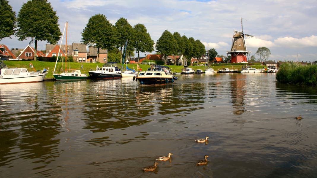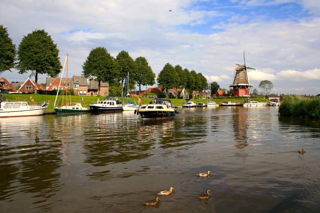


We set off early in the morning. The murmur of the boat's diesel engine mingles with the chattering of greylag geese and the scent of sweet grass and water. The sky is cloudy, but high in the north, just above the horizon, lies a strip of blue: the Wadden Sea in the morning light. We are about 10 kilometres from the North Sea as the crow flies. We've come from Zoutkamp and have set course for the Lauwersmeer, an inland lake that was a bay just two generations ago - like the Dollart and Jade Bay.

From the Lauwersmeer, after a detour to the ancient Frisian town of Dokkum, we want to sail the Lits-Lauwersmeer route. The second chapter of our journey through the Dutch provinces of Groningen (BOOTE 5/12) and Fryslân ends as it began - in the countryside, with birdsong and the sound of reeds, deep in the heart of De Alde Feanen National Park.

Zoutkamp remains behind, as does the Reitdiepbrug. It marks the mouth of the Reitdiep into the Zoutkamperril, which now takes us on to the Lauwersmeer. In the meantime, we are joined by the river that gives the Lauwersmeer its name: the Lauwers, which joins the Zoutkamperril as the Munnekezijlsterriet not far from the Reitdiepbrug.
It must have been a terrible storm surge that hit the Netherlands in 1280.

In the north, it tears a huge piece of land away from the coast and leaves behind a bay like an open wound: the Lauwerszee. From then on, ebb and flood currents shaped the area, creating sandbanks and tidal creeks. The former mainland is transformed into an extension of the Wadden Sea, the bay becomes an estuary of several rivers.
In the seventies of the 19th century, the first major coup against the omnipotence of the tides was successful. A new dyke between Zoutkamp and Nittershoek, around 4 km to the south-west, seals off the Reitdiep from the Lauwerszee and makes Groningen harbour tide-free further upstream. The Groote Provinciale Sluis in Zoutkamp becomes the "gateway to Groningen", which has been open most of the time since the Lauwerszee was completely closed a good 40 years ago. There is a movable bridge above the lock - the Reitdiepbrug.
The Lauwers, a stretch of border river between Groningen and Friesland, was given a new bed as part of the dyke construction project in the 1870s. First, its former mouth into the Reitdiep south of Zoutkamp was cut, then it was channelled into a ditch parallel to the Reitdiep. The Lauwers, known here as the "Munnekezijlsterriet", is then led to the new dyke, through which another sluice, the Friese Sluis, passes. It is still in operation today. A 2.50 metre high, fixed bridge spans it - too low for us. If you can fit your boat through, you can sail up the Lauwers to Stroobos on the Prinses Margrietkanaal.
The protective measures of 1874-78 freed the hinterland from tidal pressure, and the separate drainage of the Reitdiep and Lauwers - the former was taken over by Groningen, the latter by Friesland - probably also made a number of other things easier. The construction measures could not prevent the Lauwerszee from remaining the gateway to devastating storm surges.
The flood drama of 1953 and another storm surge less than two years later create a need for action. In 1961, work began on the construction of a 13 kilometre long Afsluitdijk. Eight years later, the open Lauwerszee has become the tide-free inland lake Lauwersmeer. Nature began to change and a landscape was created that was recognised as a national park in 2003 (www.np-lauwersmeer.nl).
Pleasure craft are welcome on the water areas, which make up a third of the site. There are already natural stopping points on the Zoutkamperril, but it is even nicer directly on the Lauwersmeer. A small drawback: the rest areas are mostly located outside the marked channels and beyond the 1 metre depth line. The approaches have since been adapted to fairway conditions - but still, plumb the depths!
The Lauwersmeer area also has a number of well-equipped harbours. The marinas of Hunzegat (Zoutkamperril), De Raskes (Raskes) and Lunegat (Dokkumer Djip) are located on the edge of the area. Lauwersoog and Oostmahorn are the places to be with your nose in the sea breeze.
Lauwersoog is a comparatively young harbour complex that was created after the completion of the Afsluitdijk and is primarily geared towards fishing, ferry services and leisure shipping. On this side of the sea lock, for example, the Jachthaven Noordergat and the harbour facilities of Camping Lauwersoog offer guest accommodation, while the Passantenhaven is located on the Wadden side. There is so much to do in Lauwersoog: cycling in the Lauwersmeer National Park, eating well in the fish restaurants in the harbour or crossing over to the North Sea island of Schiermonnikoog, which also has national park status and can be reached by ferry or on your own keel. At Camping Lauwersoog you can also buy the essentials. The supermarket in the fishing harbour no longer existed when we visited.
Further to the south-west, opposite Lauwersoog, is Oostmahorn. Since the closure of the Lauwerszee, the former ferry harbour has taken a back seat, so to speak. Although excursion boats to Schiermonnikoog still depart from here, the actual ferry business has long been handled by Lauwersoog. And so Oostmahorn welcomes us a little sleepy.
The marina is bordered by holiday homes, seagulls sail overhead and the air tastes of sun and sea. We can stop for a bite to eat right in the harbour, and a few steps further on, the "Lauwersmeer Paviljoen" restaurant invites us to linger. Oostmahorn's clocks clearly go slower, even at the Landal Esonstad holiday park. Practical: the supermarket and restaurants there are within easy reach of the marina.
The flag of Friesland flies right next to the entrance to the supermarket. Its cloth shows seven red water lily leaves on four blue and three white diagonal stripes - a reminiscence of the seven free medieval maritime lands of Friesland. On our trip from Lauwersoog to Oostmahorn, we imperceptibly changed provinces. While the eastern part of the Lauwersmeer belongs to Groningen, the western part is Frisian.
And just as the Reitdiep was once the North Sea access for Groningen city, in the old Lauwerszee days the Dokkumer Grutdjip connected one of the oldest towns in Friesland with the open sea - Dokkum. The town benefited from its strategically favourable location until well into the 17th century. As the Dokkumer Grutdjip became increasingly silted up, Dokkum lost its prominent position. In 1729, the Dokkumer Grutdjip was sealed off from the Lauwerszee and a sea lock was built at Dokkumer Nieuwe Zijlen.
Today there is the Willem Lorèsluis, a purely inland lock, which we have to pass on our way from Oostmahorn to Dokkum. We reach it via the Dokkumer Djip, a former branch of the Lauwerszee and similar to the Zoutkamperril. The fairway is marked and there are also a few nicely situated jetties. The Dokkumer Grut-djip begins just above the lock. It is now about 11 kilometres to Dokkum.
We do not experience any shoals, which are possible due to slipping banks. The journey is idyllic through and through. There are lovely moorings at the Dokkumer Grutdjip, but we are drawn onwards to Dokkum. There we take out the mooring lines on the Woudpoortsgracht canal to the east of the Woudpoortbrug - on the southern bank, the northern bank is reserved for deep-draft sailing yachts. Those who prefer a more picturesque setting should head for the Sudergracht on the other side of the mobile Woudpoortbrug or moor their boat in the Admiraliteitshaven, which is also accessible from the Dokkum Grutdjip without height restrictions.
Here, in the Admiraliteitshaven, beats the heart of the old fortified town of Dokkum. From the Woudpoortsgracht canal, we stroll into the centre in just a few minutes, discover shops and bars and marvel at the historic house fronts. And time and again we come across traces of a certain Wynfrith.
It is said that he was a handsome man. Persistence was undoubtedly part of his job, but in the end there was perhaps also a dose of stubbornness involved - after all, why did the old warhorse set off on the arduous journey to Friesland once again? Boniface, who was actually called Wynfrith and was a cleric of distinction, could have put his feet up, but he travelled to Friesland once again as a missionary and was promptly killed near Dokkum. Whether he sought martyrdom, fell victim to a political assassination or was simply relieved of his luggage remains a mystery.
But the event of 754 had miraculous consequences. Boniface's death and the fact that his steed had unearthed a beneficial spring in time attracted free pilgrims to Dokkum from then on. Rome elevated Boniface to the status of a saint, and the tourism promoters of our time gave him a social media presence. And so the old comber can tweet today in a very hip way: "Unruly people, the Frisians, but they live fantastically ..."
We realise just how cosy Friesland is the very next day. We start in Dokkum with the destination Lits-Lauwersmeerroute and end up in the countryside once again. The Lits-Lauwersmeerroute, which is a good 40 kilometres long, is a waterway that was once used to transport peat and was reactivated for recreational boating in 2005/2006 as part of the Friese Merenproject (www.friesemeren.nl).
In addition to the Lauwersmeer, it is named after the small river De Lits to the north of Drachten. Formally, the route links Dokkum with Drachten. Ultimately, however, the Lits-Lauwersmeer route is also a link between the two national parks of Lauwersmeer and De Alde Feanen. The fact that the route also runs through a so-called National Landscape - the Noardlike Fryske Wâlden (www.noardlikefryskewalden.nl) - makes the Lits-Lauwersmeerroute a remarkable project. It does not provide spectacular insights, but once again it is the quiet tones that resonate.
From Dokkum, the Lits-Lauwersmeer route goes via Dokkumer Grutdjip to Dokkumer Nieuwe Zijlen and from there initially turns south-westwards. Soon after Dokkumer Nieuwe Zijlen, a waterway branches off to Kollum on our port side. There are plenty of passing places on the eastern edge of the town. The fixed bridges there (clearance height 3 metres) are not a problem, as there is a height limit for the Lits-Lauwersmeer route anyway: a maximum of 2.95 metres. Kollum, also known for its flavoursome cheese, is a tranquil spot with shops and restaurants. Well worth a visit.
The water below us is now called Nije Swemmer. Again and again, as throughout the rest of the Lits-Lauwersmeer route, we come across simple but decent resting places. There are also several cosy marinas along the route between Dokkum and Drachten - making water sports fun all round. At Westergeest, the Strobosser Trekfeart from Dokkum joins our route - an alternative access to the Lits-Lauwersmeer route for those who already had the Dokkumer Grutdjip under their keel on the outward journey to Dokkum and are looking for a change.
The Lits-Lauwersmeer route now gradually turns southwards. We reach Zwaagwesteinde (De Westereen in Frisian) via the Nije Feart. The town has a beautiful waterfront and the most important amenities. We liked the Passantenhaven De Westereen as a mooring option. If you have children on board, you should drive about 1 kilometre further and call at Jachthaven 't Eibertsnest. The well-kept harbour is just 2 km from a wonderful play park - Sanjesfertier (www.sanjesfertier.nl).
Kûkhernster Feart and Stoppelsoal, the next sections of the Lits-Lauwersmeerroute, are nice to cycle, but don't have any particular appeal. The Burgumer Mar, which is crossed by the Prinses Margrietka-naal, does not leave a lasting impression either. We take the buoyed fairway to the southern shore of the lake and change to De Lits. We follow it uphill and soon reach the village of Eastermar. The marinas of Watersportbedrijf De Lits and De Komerk offer places to stay. You can stock up on supplies in the village and stop for a bite to eat.
The best thing is that you can explore the Noardlike Fryske Wâlden National Landscape from Eastermar - for example on one of the designated hiking routes (www.tip-eastermar.nl). The area is also very attractive from the water. South of Eastermar, we travel between reed-lined banks. Canada geese rest in a meadow, a little further on fishermen bring in their catch. Then, sparkling in the sunlight, Lake De Leien lies in front of our bow. The marked fairway also leads past simple moorings. But some of the simple plank constructions only seem to attract birds to spend the night - a pity really.
We say goodbye to Lits and De Leien and are now on the Peinder Ka-naal. The waterway forms the southernmost section of the Lits-Lauwersmeer route and looks like a river landscape in places - a brief pleasure as the industrial harbour of Drachten comes into view. To the south-west of this, the Nije Drait leads to the De Drait marina, which has a generous number of guest berths. The centre of Drachten is around 4 km away (bus connection). It's hard to imagine that the town grew out of a few poor peat-cutters' huts in the middle of the 17th century.
Peat, used as fuel, was a valuable commodity in those days. And as in the Groningen area, demand also fuelled the extraction here. The search for "brown gold" left its mark on the marshy region. Ditches and canals, ponds and pools tell the story of peatland colonisation to this day - probably most magnificently in De Alde Feanen National Park (www.np-aldefeanen.nl). On Wide Ie and Headamsleat we enter this strange world that seems to consist only of water, forest and reeds.
Almost all of the park's waters can be navigated. It goes without saying that the area attracts numerous skippers every year. Earnewâld is the tourist centre with shops, restaurants and the De Alde Feanen visitor centre. Over the next few years, the village aims to develop into Friesland's "green water sports centre". A new harbour facility next to the tourist office and larger berths in the pedestrian harbour are already ready for use.
We set off to venture deeper into the nature reserve. Detailed maps and beacons on land help with orientation. Sometimes a good nose doesn't hurt either. Then it happens. We are on one of these typical lakes, the Saiterpetten, when the echo sounder goes off. The chart promises us a water depth of 1.20 metres, but the device won't calm down. When the depth gauge only signals 0.20 metres of water under the keel, i.e. a depth of just under 0.95 metres, we turn around and feel our way back. Perhaps the transducer was just confused by greenery, but it could also have been caused by a muddy deposit - this can happen in the backwaters of De Alde Feanen.
There are a number of moorings and it's hard to say which is the most romantic of them all. We head for the area of De Alde Feanen that once served as a manorial hunting ground and was therefore named "Princenhof". We moor at Prinsendyk and are alone with nature. Reeds sway rustling in the wind, rippling waves play around the jetty posts and boat hull. A pair of coots bring out their chirping offspring and soon retreat back into the protective thicket on the shore. The day draws to a close, the first cirrus clouds herald rain. But what do we care about tomorrow? All that matters now is the moment.
WHAT SKIPPERS NEED TO KNOW
Boat We made the trip on a Jeanneau Merry Fisher 805, length 8.25 m, width 2.94 m, draught 0.74 m, clearance 2.71 m, engine 200 hp Nanni diesel.
Water data There are six movable bridges (BB) and one lock on the route described. For operating times and details, see "Cruising literature" and "Practical links". As the Lauwersmeer also serves as a water reservoir, its water level can fluctuate. This can lead to subsidence on the Dokkumer Grutdjip, for example. According to Friese Meren, the Lits-Lauwersmeer route is navigable with a draught of up to 1.50 metres. In the De Alde Feanen area, the maximum draught in the main fairway is 1.20 m, according to Wateralmanak 2, while secondary waters are often only 0.80-1.20 m deep. For further details on the depths of the waters travelled, see "Cruising literature". The names of the waters used here correspond to the names on the ANWB charts.
- Zoutkamperril: max. 9 km/h
- Lauwersmeer: max. 12 km/h
- Dokkumer Djip (Lauwersmeer to Dokkumer Nieuwe Zijlen): max. 9 km/h, BB
- Dokkumer Grutdjip: max. 9 km/h, BB
- Strobosser Trekfeart (Dokkumer Grutdjip - Nije Swemmer): max. 6 km/h, fixed bridges max. clearance height 3.00 m
- Sylster Ryd to Kollum: max. 6 km/h, BB, fixed bridges max. clearance height 3.00 m
- Lits-Lauwersmeer route (Nije Swemmer, Nije Feart, Kûkhernster Feart, Stoppelsoal): max. 9 km/h, fixed bridges max. clearance height 2.95 m
- Lits-Lauwersmeer route (Burgumer Mar): max. 9 km/h
- Lits-Lauwersmeerroute (De Lits, De Leien, Peinder Kanaal): max. 6 km/h, BB, fixed bridges max. clearance height 3.27 m
- Wide Ie at Drachten: max. 12.5 km/h in the fairway, outside max. 9 km/h
- De Alde Feanen: max. 9 km/h in the main fairway, side waters 6 km/h, BB
Our trip was 95 kilometres long. The distance can easily be covered in four to five days.
Berths Other mooring options along the route are described in Wateralmanak 2, which also lists tariffs and service facilities such as petrol stations and boat slips. You can moor free of charge at Marrekrite moorings (max. three days).
Driving licence If the boat is shorter than 15 m and not faster than 20 km/h, the route can be travelled without a boating licence.
Practical links
- www.fryslan.nl
- www.eileen.nl/water
- www.marrekrite.nl
- www.beleeffriesland.nl
Cruise literature

