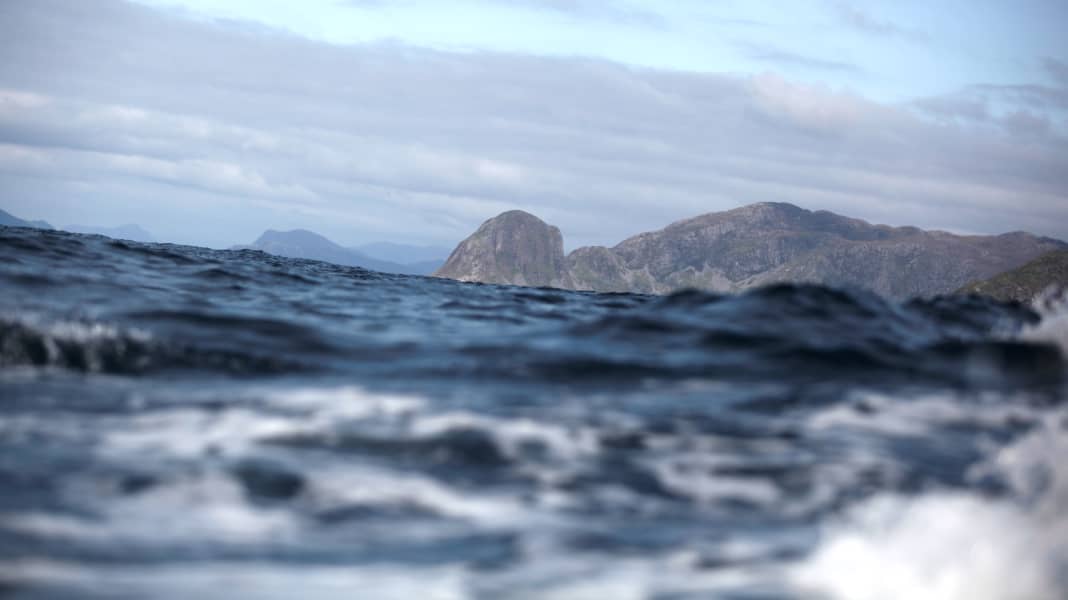


In heavy weather, there are few truly hospitable corners of the Norwegian west coast: the backbone of the country, a mountain range of granite and gneiss, thrusts upwards here, and the waves of three seas surround thousands and thousands of islands, reefs and cliffs - a black, sharply jagged labyrinth. Although there are only 1750 kilometres as the crow flies between the Lindesnes lighthouse in the south and the world-famous North Cape plateau pointing out into the Arctic Ocean, the rugged coastline between them, furrowed by fjords, measures more than ten times that distance.

A fully equipped weather poison kitchen
The central, longest stretch of coastline from Bergen to Tromsø borders the Norwegian Sea. Internationally, it is better known as the "Norwegian Sea", an Atlantic outcrop with the dubious reputation of a fully equipped weather poison kitchen: the warm Gulf Stream and the icy air from the north and west create an explosive climate mixture. In winter, the Arctic Ocean sends one polar low-pressure area after another on its way, and even in summer it causes erratic weather: rapid changes with strong winds, storms and dense fog are the order of the day.
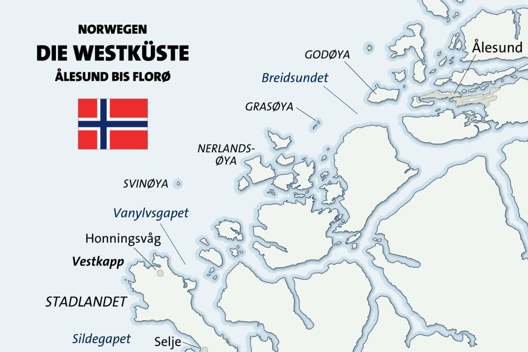
It is therefore hardly surprising that the most notorious obstacle to shipping along the coast lies in this area. However, it's not the barren arch of the Lofoten Islands, which is cut into the sea far to the north near Narvik. It is a peninsula in the south that inspires the most respect among skippers: Stadlandet. South of the harbour town of Ålesund, where the coastline coming from the north-east changes course slightly to the south, it juts out into the open sea - like a clenched fist of rock that smashes everything the sea can throw at it, even in the heaviest storm.

The Vestkapp only goes "round the outside"
The bare flanks of Vestkapp rise up at its outermost point, almost 500 metres high and visible from afar. Nobody seems to be interested in the fact that the most westerly point in Norway is actually a good bit further south. In reverent recognition of its nautical significance, the "name of honour" was given to Stadlandet instead: For long stretches, the Norwegian coast can be navigated under the protection of offshore islands, but at Vestkapp it is only "around the outside" - and so wild that even large freighters and cruisers "have a washing machine" when the breakers roll over the forecastle and the spray flies right up to the bridge windows.
For well-paying passengers at least, this is often an adventure to get used to, but what about leisure crews? If you're coming from the south and want to reach the Geirangerfjord, Trondheim or even further to the Lofoten Islands on your own keel, you can't avoid this great unknown in your cruise planning - if you don't have enough time, perhaps even in the literal sense.
Stadlandet is notorious for its unpredictable sea conditions, even in good weather. Even old swells, in combination with the tide and changing light winds, can cause a lot of disorder over the uneven rocky ground. Crossing seas are not uncommon, and the danger of having to hope for quick help in the event of an engine failure without the possibility of an emergency anchorage is very real. The warnings in the coastal handbooks are correspondingly clear, regardless of which country they come from. The marine weather forecast must be correct before the circumnavigation is attempted.
The first tunnel for large ships
Safe is safe. But to be on the safe side, rich Norway is taking an extreme measure: the world's first large shipping tunnel is to be blasted through the base of the 28-kilometre peninsula, which is just under two kilometres wide: clearance height: 37 m, fairway width: 26.50 m, water depth: 12 m. In ten years' time, the billion-euro project is due to be completed, which should prevent many grey hairs on board at any time of year - whether in the cockpit of a yacht, on the bridge of a trawler or in the panorama bar of a modern Hurtigruten passenger ship.
But tomorrow is not today, and who knows whether even the Norwegian engineers, who are experienced in tunnelling, won't encounter resistance deep in the mountain that will at least delay the schedule? For us, at any rate, Vestkapp is a firm favourite this time. We flew to Ålesund for this, because the trading town built on the water will be our starting point: This is where we want to board the "Rolling Swiss II" tomorrow. The Swiss Cruising Club's own motor yacht is completing its cruising programme in Fjordland this summer 2013. Now, in mid-July, half of the season up here is already over, and after a leg through the majestic Geiranger, the Trader 42 with the Swiss cross on the flagpole is heading south again. We want to accompany the crew as far as Bergen and explore the 350 kilometre long Sognefjord on the way - if the Vestkapp plays along and doesn't keep us too long, of course.
Because although the weather gods have been extremely merciful in recent weeks and have poured out so much sunshine along the coast that the locals have been rubbing their eyes, there is no guarantee that we can expect the same mildness. Quite the opposite: when we look out of the hotel window, we see a land shrouded in mist and rain-soaked roads. In the dawning twilight, we walk along Keiser Wilhelmsgate to Ålesund, which divides the old town centre. Not only the pleasure boats are moored here on thick tyre fenders, but also the Redningsselskapet rescue cruiser, ready for action with humming fans and bright deck lighting.
On time like a Swiss clockwork
We get some baked cod from a stall and sit down on a heated bench, almost forgetting the fine drizzle. At the same time, we can watch the "Nordlys" cast off all lines at the Hurtigruten berth and steam towards the open sea with a billowing plume of smoke. It's not until midnight that we head back to the hotel, past dark shop windows displaying oilskins alongside T-shirts with trolls and moose, and past a group of girls laughing as they jump from the steps of an algae-covered staircase into the cold water of the harbour at Apotekertorget. As punctual as clockwork, the "Rolling Swiss II" rounds the pier head the next morning; we can see her from the breakfast room. Time to go!
Two hours later, our bags are stowed on the yacht and there are two heavily laden green shopping trolleys from the Kiwi supermarket just opposite the boat's petrol station on the pier. The rest of the crew, which consists of a couple who are keen travellers and skipper Marc, have been on board for three days - so this stopover provides the perfect opportunity to top up the tanks and storage lockers once again and replenish any missing items. Only fish is not on the shopping list; we hope to get it fresh from the fishing rod at Vestkapp.
Into the world of the offshore islands
We read north-west 2-3 on the Navtex in the saloon, so the wind has dropped significantly after two gusty days. Good for us! Under an even grey sky, the "Rolling Swiss 2" leaves Ålesund and follows a course to the southwest, into the world of the offshore islands - and into a group of puffins. The birds with the colourful beaks eye us suspiciously and keep clear with powerful paddle strokes.
Instead, we now have to contend with a decent residual swell from abeam, which rolls in from the North Sea and causes us to roll quite a bit in the open Breidsundet. The flat rocky ribs of Grasøya with its lighthouse offer a little protection, but the first "dance of the day" downwind of the high island is only over after the filigree prestressed concrete arch of the Remsøya bridge.
The plotter reveals the names of the places that pass by on either side, while our course line follows the marked fairway from waypoint to waypoint: We pass between Nerlandsøya and Fosnavåg and continue southwards across the Herøy fjord. Dark rock characterises the shores, interspersed with meadows and pastures with scattered houses and farms in rusty red and bright white. Mighty fishing trawlers wait at lonely piers for higher catch quotas.
Spray explodes on black rocks
As we round the southern tip of Kvamsøya, a high-speed water taxi with roaring jets blows past on the opposite course.
We have already travelled almost 30 nautical miles since Ålesund, Vestkapp is within reach - and even the sky is clearing. All that now lies between us and Stadlandet is the turbulent Vanylvsgapet; the high coastline of the peninsula is already ahead on our port side. Our destination for the day is right at its northern tip - the bay of Honningsvåg with its small, sheltered harbour.
But now we're heading into the swell - the notorious cape doesn't want to let us get away without a taste of its prowess. The seas are unpleasantly steep and the distances between the crests are short. The waves are around two metres high when the local wind suddenly turns 180 degrees and makes the water even more turbulent. The hull roars while our traders work against it with both engines and the bow repeatedly kicks in so hard that the Norwegian Sea baptises anyone who sticks their head out of the cake stand for too long.
Because the panorama is absolutely fantastic: while the spray explodes on the black cliffs, rays of sunlight wander over the green slopes. The colour of the sea changes from lead grey to deep blue - depending on the clouds and the viewing angle. We are only slowly gaining height; and then there is another critical point when we have to turn into the approach to Honningsvåg and the sea is across again: Watch the waves, wait for one more crest, then lever forwards and round! If you want, you can now even watch the entry from the foredeck - without the risk of a salty wave shower.
Compatriots where you wouldn't expect them
The moving sea gently pushes us between the breakwaters into the bay. A black and white stone beacon marks the narrow passage. Then we are suddenly in calm water and shortly afterwards safely moored at the floating jetty of the small harbour on the southern shore. We actually get our fish without any problems: saithe, cod and tusk straight from the boat, more than enough for the next two days.
But our flag also leads to another encounter: another angler speaks to us - in Swiss German. A few years ago, he and his family swapped the local mountains for the Norwegian coast and now run a campsite nearby. We are spontaneously invited on an excursion to Vestkapp itself, which we would never have reached on foot. And so, after dinner, the whole crew climbs into the minibus of our hospitable compatriots and sets off on a tour of the countryside.
Up to the windy Vestkapp
We climb 500 metres between high moors up to the windy plateau. We park the car in the car park in front of the boarded-up viewing café and walk the last few metres up to the white dome of a weather radar station over spongy, muddy ground soaked with rain. The top of its antenna mast disappears into the clouds, but the view extends in all four directions over the sea and islands. 62°11'18'' north and 5°7'33'' east are the coordinates of this extraordinary place.
The sky has closed up again the next morning, and as we round the Vestkapp on its own keel and look up to the point where we were standing yesterday, the wind has almost completely died.
Under the old, oily swell, the sea rises sluggishly and barely noticeably. Many fishermen and sports skippers are now out and about, taking advantage of the good opportunity like us. The sharp contours of Stadlandet slowly fall away astern. The journey across Sildegapet and through Ulvesund towards Måløy is almost hypnotically calm. After another long day, we finally reach Florø, where
where we find ourselves in the middle of preparations for the annual boat festival. Well timed - after all, we now have a reason to celebrate!
Background: the Cruising Club of Switzerland
The motor yacht "Rolling Swiss II", with which we travelled on this trip, belongs to the Cruising Club of Switzerland (CCS) and is used for training and travelling cruises. The sailing areas change from season to season in order to be able to offer a varied and attractive programme. This year, the 13.30 metre Trader 42 is heading for the English Channel and Brittany. The seaworthy semi-glider is technically state-of-the-art. Three cabins offer space for a total of six crew members. The motorboat department forms an important division of its own within the club, which is one of the largest in Switzerland with around 6500 members and is a leader in the field of deep-sea training in recreational boating. www.ccs-motorboot.ch
Nautical information
The Norwegian west coast is quite challenging in the southern area described above, even in summer. Rapid changes in the weather and locally varying conditions must be expected. The Norwegian Meteorological Institute (www.yr.no) also provides up-to-date and very detailed weather information on Eng-
lish. Further information can be found in the current official nautical publications and in the cruising literature.
Up-to-date charts and coastal manuals must be on board and sailing routes must be precisely prepared. Although the fairways are precisely defined, buoys are rare and course changes are usually indicated by beacons, which can be very inconspicuous as landmarks during the day. Caution is also advised in uncertain weather, especially if there is no radar or plotter with AIS overlay on board: The sometimes very narrow fairways are also used by large commercial vessels and very fast catamaran ferries. The harbours are generally well equipped for this, and there are boat refuelling stations in almost every town.

