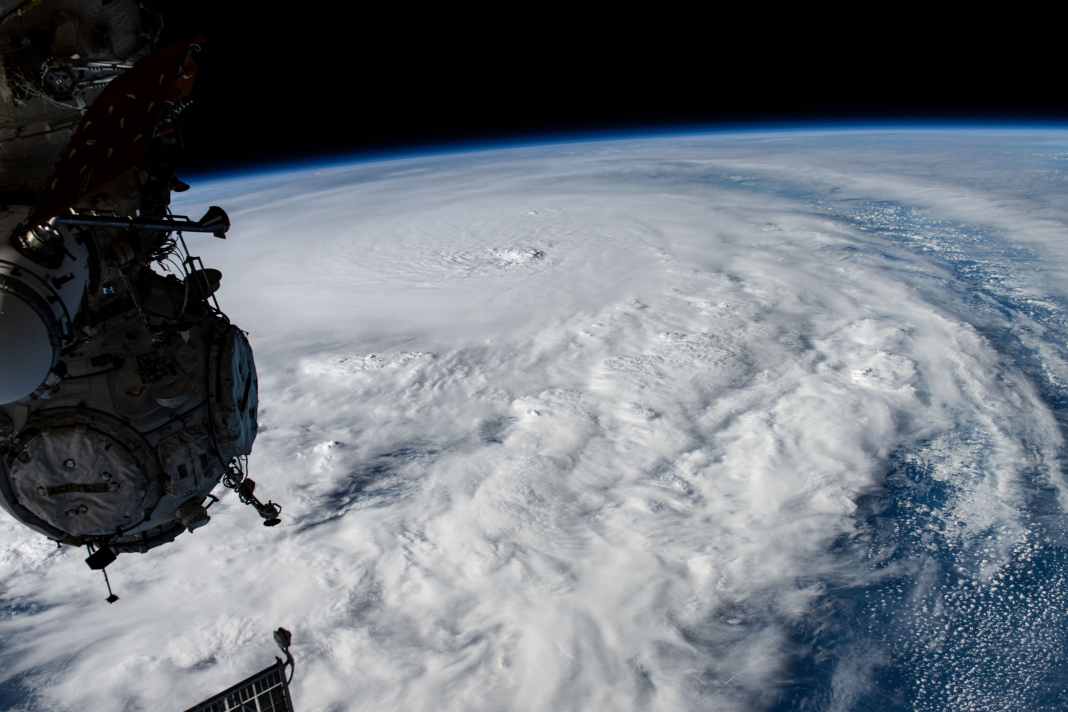


With global warming, particularly strong tropical cyclones are becoming more frequent. Some of these systems are now travelling far to the north, can cross the Atlantic and reach European coasts. We spoke to meteorologist Sebastian Wache about how a hurricane develops and what the weather phenomenon means.
Researchers largely agree that tropical cyclones are becoming more intense on average. A key driver is the warming of the air and sea surface. Rising temperatures mean that the atmosphere absorbs more water. The warmer water temperature provides additional moisture.
The intensity of hurricanes is increasing
Scientific data shows a clear accumulation of so-called major hurricanes in categories three to five. Eight of the ten most active years since 1950 have occurred in the past three decades. The ACE index, which measures the energy released over the entire lifetime of a storm, is often used to categorise the total energy of tropical cyclones. This index has shown a significant increase since the mid-1990s. This shows that, on average, storms remain strong for longer and release more energy over their lifetime than in the past. This long-term shift to higher intensity ranges is considered a direct consequence of global warming, which also increases the potential maximum strength of tropical systems. Meteorologist Sebastian Wache confirms this trend:
There is a clear accumulation of category 4 and category 5 hurricanes in particular."
Weather models at the limit
Another phenomenon is also coming into focus, namely the rapid intensification of certain hurricanes, also known as "rapid intensification". The wind speed increases sharply within a short period of time, sometimes from tropical storm to hurricane force within a day. This can mean that a system that reaches around 70 km/h in the morning can have wind speeds of well over 150 km/h the next day. Such developments considerably shorten the warning time and challenge the forecasting models.
Read also:
Rapid intensification occurs particularly frequently when several meteorological factors come together, such as very warm surface water and high humidity. Hurricanes in the Caribbean, for example, can increase by several categories within a day if the conditions are right. As the basic energy in the system increases, so does the probability of high-intensity storms over northern Europe, regardless of whether their origin is tropical or Atlantic.
Storms on new paths
With the warming of the Atlantic, the "runway" of tropical storms is lengthening. Warmer surface waters reach further north, so that hurricanes retain energy for longer and are more frequently caught in the path of the jet stream, which steers them north-eastwards. Research results from high-resolution climate models indicate that the probability of hurricane tracks over the North Sea and the Bay of Biscay could increase by the end of the century.
However, weather expert Sebastian Wache is sceptical about this development. So far, the trend has only been seen selectively. High-pressure areas in the north and the so-called cold block south of Greenland, which is fed by meltwater, would continue to act as natural barriers on the transatlantic path of the hurricanes. Overall, it can be concluded that although the physical conditions for transatlantic storm paths are changing, the actual frequency of such events depends heavily on other factors in the North Atlantic.
When former hurricanes reach Europe
The storms that nevertheless reach Europe usually occur as post-tropical cyclones (PTCs). They are not per se stronger than all low pressure systems in the mid-latitudes, but statistically have a higher energy level more frequently. The study by Sainsbury et al. concludes that PTCs reach storm intensity around ten times more frequently than typical European lows. However, this is a probability statement, not a characteristic of each individual PTC.
However, Sebastian Wache warns against drawing too simple a conclusion: "This increased probability cannot be attributed exclusively to former hurricanes." He emphasises that intense Atlantic lows are also increasingly benefiting from warm water and moist air masses. The common denominator is therefore: with the growing basic energy in the system, the probability of high-intensity storms over northern Europe increases, regardless of whether the origin is tropical or Atlantic.
Changing storms
Many of the systems that reach Europe can intensify again on their way across the North Atlantic. This happens when warm and humid air masses from the south meet much colder air in the north and the low pressure area deepens rapidly. Under such conditions, it is possible for a previously rather inconspicuous low pressure system to gain strength again as soon as it reaches European regions.
Meteorologist Sebastian Wache emphasises that it is not just individual weather conditions that play a role, but long-term climatic changes. As a result of global warming, entire climate zones are shifting to new regions. Dry and hot regions are moving closer to Europe, while at the same time warmer sea surfaces and more humid air masses are also occurring more frequently at higher latitudes. This combination can create conditions in various parts of Europe that, under certain circumstances, favour the formation or renewed strengthening of strong low-pressure systems.

David Ingelfinger
Volontär

