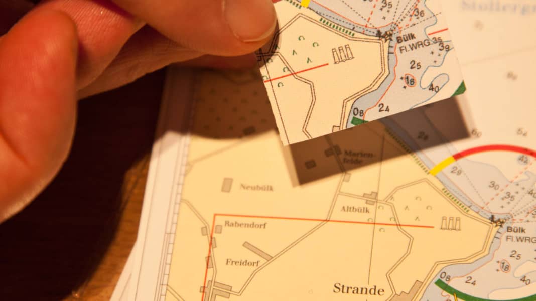
For legal reasons alone, a paper chart that corresponds to the latest edition must be used for navigation on pleasure craft. There are two ways of doing this: Either the skipper regularly replaces all old charts as soon as a new edition is published. Or he can correct the chart sets already on board. But how exactly does this work?
Firstly, a distinction must be made between professional and privately used orientation aids. On a cargo ship, all changes to the nautical conditions must always be promptly entered into the official charts to be used. The navigation officers are responsible for this. They receive the updates from the hydrographic institutes of the respective countries, usually on a weekly basis in the form of the so-called "Notices to Mariners" ("NfS"; in English-speaking countries "Notices to Mariners", or "NtM" for short).
As recreational craft are generally used less intensively, a yearly chart is sufficient for them from a nautical point of view. Furthermore, sailors do not need to use official charts.
Updating the nautical charts once a year is good, updating them more frequently is better
This is where private providers such as Delius Klasing Verlag, which also publishes YACHT, come into play. They offer chart sets tailored to the needs of recreational boaters based on the hydrographic data of the respective sea areas. Whereby "customised" is to be taken literally, as the format of a recreational craft chart alone differs from that of an official chart. It is simply smaller in order to do justice to the limited space available in the navigation corner. There are also differences in the type of correction resulting from the different updating intervals between commercial and private shipping.
The private providers have adapted to this. They publish updates for their nautical charts at least once a year. These contain the quintessence of the information about changes in the sailing area that has accumulated during the year, which is useful for recreational skippers.
Example: A new wreck that reduces the depth at a certain point from 30 to 15 metres will not interest most sailors unless it is in an anchorage. On a container ship with a draught of 16 metres, however, the same information will certainly be gratefully received.
Not every change is relevant for recreational boaters
Even the brand new recreational craft map is "information-calculated", meaning that it only contains selected data. The wreck mentioned in the example may not even appear in next year's edition. This reduction contributes to clarity. An update in an "Official Notice to Mariners" may therefore not even be entered in a recreational craft chart because the symbol to be changed is simply missing from the outset. The "NfS" are therefore only suitable to a limited extent for updating charts for recreational skippers.
And for yet another reason. The flood of data contained in the "NfS" is likely to simply overwhelm most leisure skippers. A weekly report from the British Admiralty, for example, is between 30 and 60 pages long. Finding the relevant information alone becomes a tedious search task. If you wanted to update a map by a year, you would have to work through all 52 weekly issues one after the other. A Sisyphean task that also harbours a high risk of error.
All this shows: The best data for correcting a map set always comes from the organisation that originally published it. To find out what needs to be changed, amateur skippers should therefore contact the chart publisher once a year. Correction sets for nautical charts are usually published before the start of the season, sometimes also in summer.
Corrections are best obtained from the publisher of the chart sets available on board
For some publishers, such an overview of the changes to be made consists of either a free PDF available on the Internet or a paper version with the same content, which the customer must order. Both contain written correction instructions as well as so-called cover sheets for cutting out and sticking onto the areas to be corrected.
- Here there are the current correction sets for the map sets of Delius Klasing Verlag
If there have been an excessive number of changes for a sea area, the paper version for a fee the relevant map sheet is included as a whole in the new correction record. In the free PDF version On the other hand, you receive all the changes in the form of text corrections and cover pages to be glued on yourself. In this case, however, the correction effort is so immense that it is better to order the paper version from the publisher.
Once the data to be corrected is finally available, accurate work is required. As nautical charts are known to get wet, it is necessary to use waterproof pens. Professionals use special ink pens with a fine nib.
Attention must also be paid to water resistance when printing cover sheets from the PDF versions. Inkjet printers are not sufficient, laser printing in colour is the safe solution. Of course, the paper version supplied by the publisher is even better. Not only because the cover sheets are printed on card paper. They are also durable and colourfast.
Make sure you use water-resistant pens, glue and printer paper
If the printout is available, a distinction must be made between two procedures: Correction with and without cover sheet. The latter means, for example, that the identification of a beacon must be changed or an obstacle removed. If, on the other hand, a depth contour has changed or a new harbour facility has been created, the cover sheets are used.
These are cut out of the correction set and glued to the corresponding place on the card sheet. It is advisable to proceed sheet by sheet to avoid unnecessary searching for the areas to be stuck on. Only when all the changes and cover sheets belonging to a card sheet have been processed - tick them off on the template! -The update status may be entered at the edge of the map. This consists of at least the date of the update and the name of the person who carried it out. Once the ink and glue are dry, you have updated your card yourself.
Of course, you could also buy new pleasure craft charts every year, but that would be quite expensive. The correction is much cheaper. And that's not all. If necessary, the updated information on the Internet as a PDF is also available where there is no chart shop around the corner. For example, during a summer cruise in an anchorage bay.
Another positive effect is that the skipper is intensively involved with the chart while working. This means that sea areas and their changes are better memorised.
The step-by-step guide for correcting nautical charts
Sharp scissors, waterproof pencil and waterproof glue stick: how to make corrections correctly
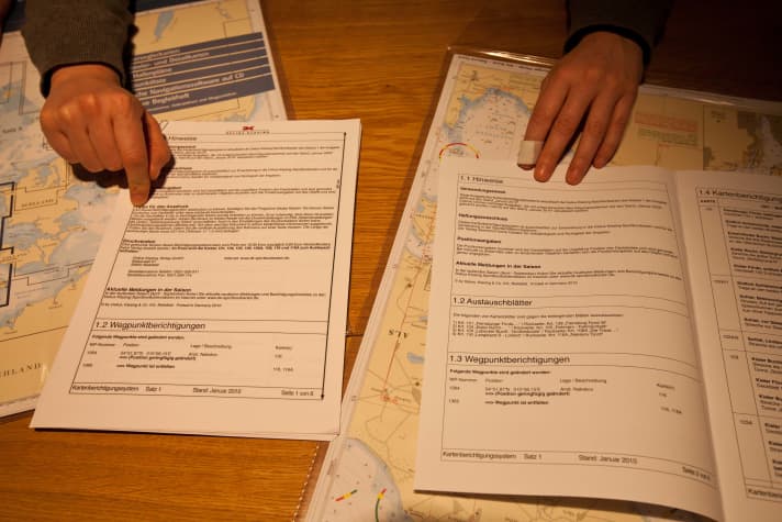
Step 1: Firstly, you should download the free update PDF (left) from the relevant map publisher. This usually eliminates the need to purchase a paper correction set (right). Sometimes, however, a provider changes the scale or the section of a map and encloses it with the correction set as a complete replacement sheet. An update via online PDF is then not possible.
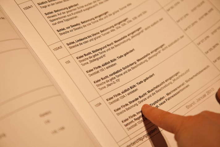
Step 2: Firstly, study all the instructions in the correction set carefully and assign the notes to the relevant sheets of the card set in question. If there is no cover sheet to stick on for a change, transfer the new information to the card with a waterproof pen. Before doing so, carefully scrape away the information that is no longer current using a razor blade or sharp scalpel.
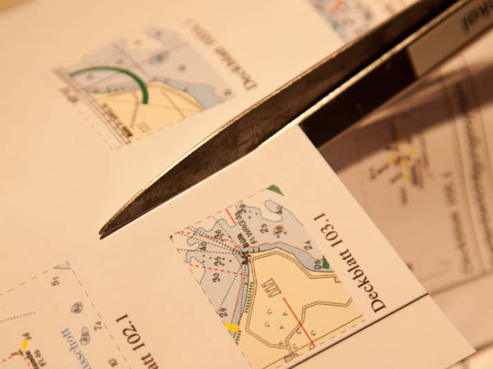
Step 3: A correction record usually contains several small cover sheets. Therefore, print the PDF in colour on high-quality paper. Do not use an inkjet printer. Laser prints, on the other hand, are colourfast when wet. The cover sheets on chart paper are included in the purchased version. Cut out the cover sheets exactly along the edges one after the other to avoid confusion.
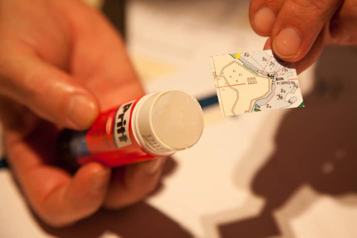
Step 4: Work neatly and do not fold the map until the glue has dried. When fitting the cover sheet, coastlines or depth lines help with orientation. With the paper updates, each cover sheet is only available once. If it breaks, the correction set is incomplete. Finally, note the status of the update in the margin of each sheet of a chart set.
And electronic cards?
If you also navigate with a plotter, you should also regularly update the map software used. There are not yet any correction sets like those for paper maps. In most cases, you have to buy a new map chip at full price. Only a few providers will exchange the old data for an up-to-date version at half the price of a new one. Nevertheless, Navionics customers receive a free online update for their maps for one year.

