Territory portrait: Shetland - Scotland's islands at the edge of the world
Christian Tiedt
· 09.04.2023


Far Haaf - in Shetland, this term stands for the edge of the world. "The far sea" is the name given to the edge of the fishing grounds, which extend from the coast some fifty nautical miles westwards into the North Atlantic. There, at the outer edge of the continental shelf, the seabed suddenly drops away steeply. The last land ends. For generations of Shetlanders, the risk of hunting for cod, ling and herring in these defenceless expanses was part of life. Their rowing boats were open sixerns, slim double enders, built along Nordic lines. The six men on board had to be storm-tested and experienced at sea, but in a way they were born with these qualifications anyway: Around the year 800, Norwegian Vikings took over the rule of the rocky archipelago from the native Picts and called it Hjaltland.
Island motto: The land is built with the law
Even though Shetland has been part of Scotland for five centuries now, the legacy of the Scandinavian settlers is still fresh and vibrant and ranges from highly official symbolism such as the regional flag, a Scandinavian cross in Scottish colours, and the island motto Með lögum skal land byggja ("With the law the land is built") borrowed from the sagas, to more "worldly" aspects such as the Up Helly Aa in Lerwick. According to ancient custom, the winter spirits are driven out on the last Tuesday in January. Real flames, torches and burning tar barrels blaze everywhere. Thousands of Vikings fill the streets, the Earl of Honour keeps order with his armoured bodyguard and, as a highlight, a replica of a longship is set alight in the darkness. After that, the party really gets going, with singing and even more fire - in the throat. The following Wednesday is also traditionally free from work.
However, the connection to the land of the ancestors has also been preserved on the water. This is hardly surprising; it is only around 200 nautical miles to Bergen. The Scottish capital Edinburgh, on the other hand, is more than 300 nautical miles away. Not to mention London, which is supposed to be somewhere very far to the south ... The sea route between Shetland and Norway became particularly important during the Second World War for smuggling daring agents back to their German-occupied homeland by secret means. More on this later.
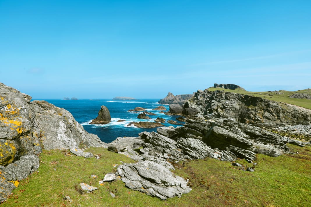
Today, fortunately, it is wanderlust, often with a dash of adventure, that attracts visitors on their own keel. And that doesn't just mean cruise ship passengers, who have become a familiar sight in the summer months, but also sports skippers and crews. Many come over from Norway, but you also see others. They are mainly sailors, but motor yachts also come to Shetland on long trips, for example as a stage on a cruise around the North Sea. The archipelago is an area in itself, with rough and gentle sides, a lively capital, spectacular nature and endless opportunities for shore leave. Even the weather is "varied". But only sunshine is boring anyway, isn't it?
Largest island of Shetland: Mainland
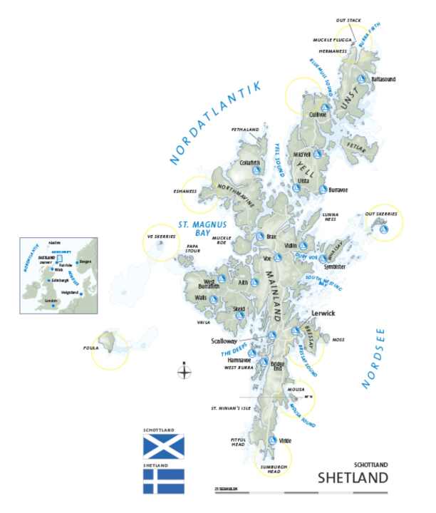
Shetland consists of around one hundred islands, twenty of which are inhabited. The largest of the bunch is Mainland. Its area measures approximately 1000 square kilometres, which is roughly the size of the island of Rügen. The large Northmavine peninsula in the north-west is only connected to the rest of Mainland by a narrow land bridge. In addition to the main town of Lerwick on the North Sea coast and the airport at Sumburgh on the southern tip, Scalloway, the most important harbour on the Atlantic side, is also located on the island. Around 1100 inhabitants are enough to secure Scalloway second place among Shetland's towns.
The harbour with its freight terminal, fishing pier and marina is overlooked by the grey walls of Scalloway Castle. In the shadow of the ruins is the museum, which, among other things, tells the most exciting story in recent history: From 1941 until the end of the war, Scalloway was the starting point of the "Shetland Bus": using inconspicuous cutters and fast motorboats, the Norwegian navy maintained a secret, highly dangerous shuttle service to their country's fjord coast. From Shetland, they brought weapons and equipment for the underground, agents and commandos; on the way back, refugees and Allied soldiers in hiding filled the boats. An impressive story full of courage and hardship. The best-known skipper was the Norwegian officer Leif Larsen, known as Shetland Larsen, who himself completed 52 voyages. However, many crews were lost as victims of the Germans or the merciless sea itself ( www.scallowaymuseum.org ).
However, the first port of call for leisure skippers will be Lerwick, a town of 7,000 inhabitants, with its shops, pubs and restaurants (including a French one), undoubtedly Shetland's "metropolis". People have made a lot of money here, with bowhead whale, salted herring and smuggled gin. Today it is tourists - among others. Due to its central location, Lerwick is perfect for exploring, most conveniently by hire car. Avis and Europcar offices are located close to the harbour. Other highlights include the modern Shetland Museum ( www.shetlandmuseumandarchives.org.uk ) and an excursion on the water to the breeding colonies of migratory birds on the steep eastern flank of the Isle of Ness off the island of Bressay, either on your own keel or by excursion boat ( www.shetlandseabirdtours.com ).
Northern Isles
The two islands of Yell and Unst form the northern part of the archipelago, the Northern Isles. They are connected to each other and to Mainland by ferries. The narrow sounds between the islands are characterised by strong tidal currents. The further north you go, the rougher the landscape and the sparser the population. Nevertheless, most of the sites from the Viking Age can be found here, with the remains of more than sixty longhouses having been uncovered on Unst alone. Shetland's most spectacular circular hiking trail leads across the Hermaness peninsula in the far north. From the grassy plateau above the cliffs, there are fantastic views of colonies of seabirds, the island of Muckle Flugga - its lighthouse was the most northerly inhabited place in the British Isles until it was automated in 1995. Another job on the edge of the world.
Service

Distances
- Heligoland-Lerwick (via SCO): 850 nm
- Heligoland-Lerwick (via NOR): 650 nm
- Bergen (NOR)-Lerwick: 210 nm
- Edinburgh (SCO)-Lerwick: 305 nm
- Wick (SCO)-Lerwick: 125 nm
- Fair Isle (SCO)-Lerwick: 42 nm
- Shetland round: min. 160 nm
Nautical information
The precinct: Shetland's geographical location alone makes it a very challenging area. Route planning, navigation, tide calculation and weather observation require a great deal of nautical experience and the suitability of the crew, vessel and equipment for sailing in the sea area in question. Although summer months only have an average of three foggy days and one stormy day, serious weather situations are possible at any time. Whether recreational craft from the EU will have to clear in and out after the end of the Brexit transition period in January 2021 was not yet clear at the time of going to press. The current customs harbour is Lerwick ( www.hmce.gov.uk ).
The harbours: Considering Shetland's remoteness, the archipelago offers a surprising number of mooring options for guest mariners. A total of 22 harbours are available throughout the area, including in remote locations (see map). Crucially, most of these harbours offer good shelter and the majority are equipped with at least a floating dock that is independent of the tide. However, only Lerwick and Scalloway have extensive service facilities. A complete overview with contact information can be found on the Internet at www.shetland.org/plan/marinas
The literature: Area guide "Orkney and Shetland Islands. Including North and Northeast Scotland". Imray, 150 p.; ISBN 978-1-78679-161-0. 46,80 €. - Various official nautical charts (Admiralty). Order all articles via: www.hansenautic.de

